Mani, Peloponnes, Griechenland
Lage
Von Agios Nikolaos in Richtung Süd etwa 3,5 km am Meer entlang. Rechts unten liegen die Felsterrassen am Meer.
Location
From Agios Nikolaos, head south for about 3.5 km along the coast. The rock terraces by the sea are located down to the right.
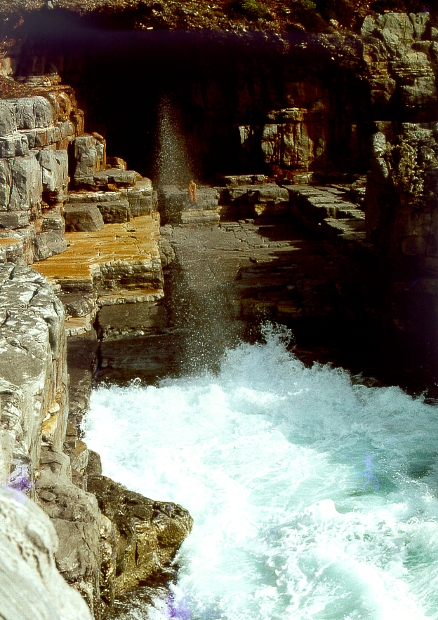
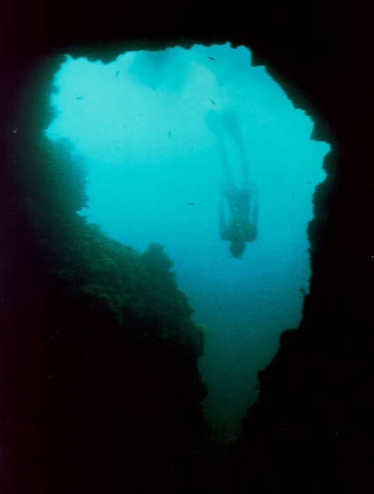
Vor dem Eingangsportal ist deutlich die für den Eingangsteil der Höhle prägende Kluft zu erkennen. Der Wellengang drückt Wasser in diese Kluft, der über ein Ausblasloch eine Fontäne erzeugt.
In front of the entrance portal, the crevice that characterizes the entrance section of the cave is clearly visible. The waves push water into this crevice, creating a fountain through a blowhole.
29.07.1976
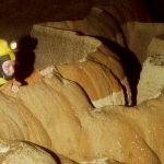
Gegen 10 Uhr steigen wir in die Höhle ein. Wir erkunden etwa 1 bis 1,5 km Gänge mit einem Abstieg zum Wasser im hinteren Bereich. Die Höhle ist teilweise spektakulär versintert. Ich bin von der Höhle begeistert. Leider ist sehr viel zerstört.
July 29, 1976
Around 10 a.m., we enter the cave. We explore about 1 to 1.5 km of passages, including a descent to the water in the rear section. The cave features spectacular sinter formations in places. I am thrilled by the cave. Unfortunately, much of it has been destroyed.


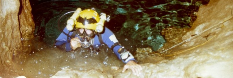
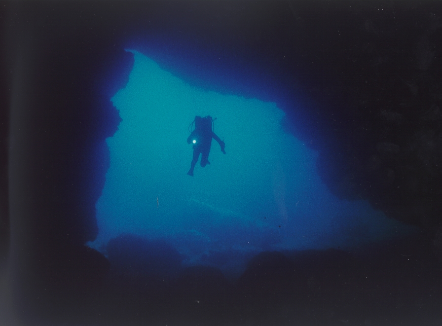
Während die anderen total geschafft sind und schlafen, gehe ich zurück, fotographiere, filme und tauche in die daneben liegende zweite Höhle. Filmen von Siphon und Fledermäusen im östlichen Gang.
While the others are completely exhausted and sleeping, I go back, take photos, film, and dive into the second cave next to it. Filming the siphon and bats in the eastern passage.
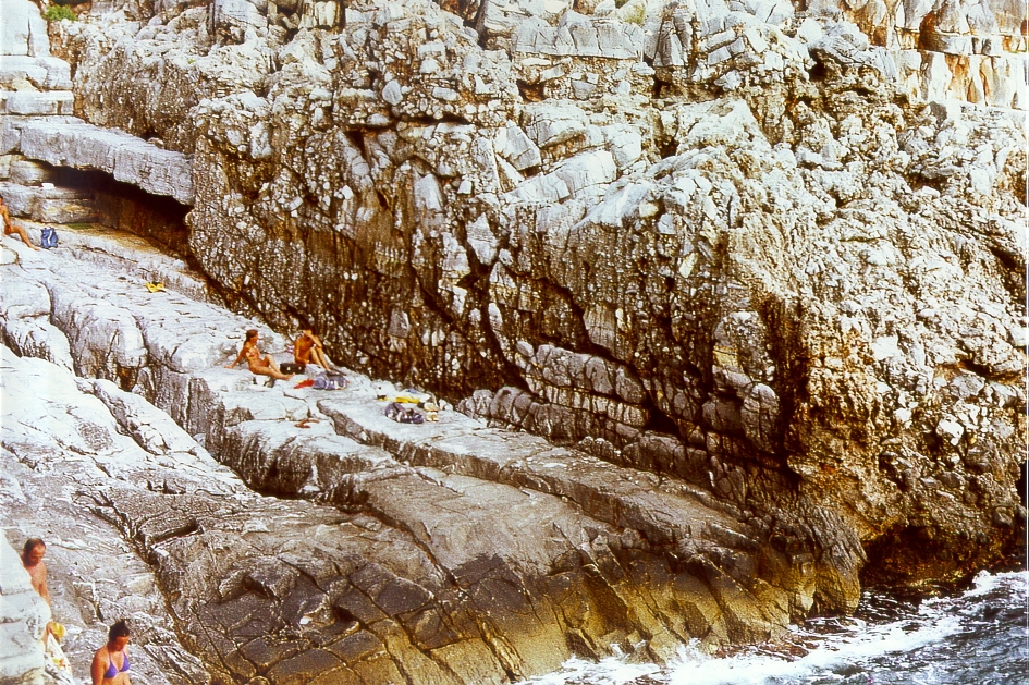
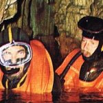
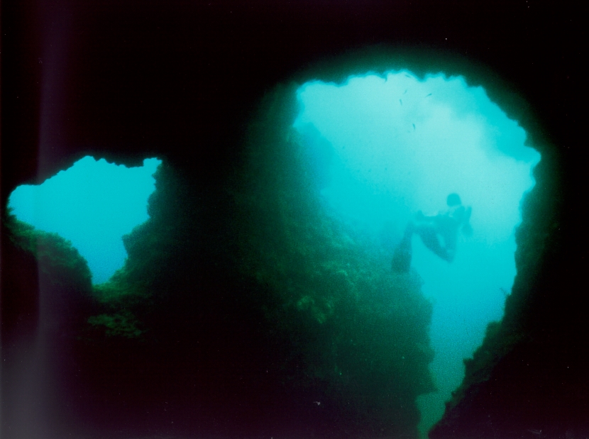
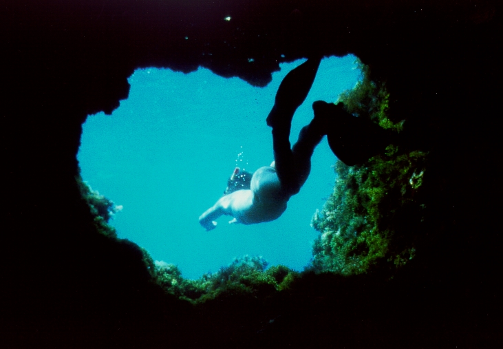
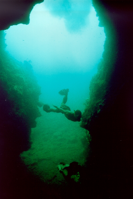
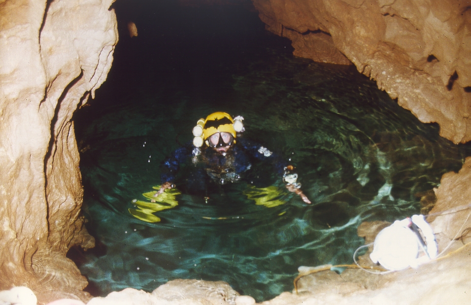
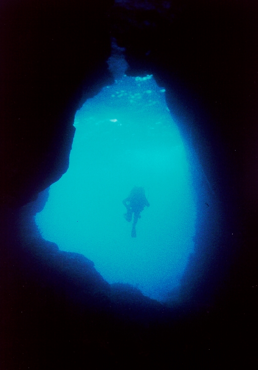
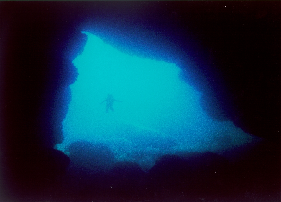
Neben der Höhle gibt es einen weiteren Höhlenraum, den man auf dem Bild an dem Felsfenster und der Höhlung über der Wasserlinie erkennt. Sie hat zwei schnorchelbare Zugänge, die uns immer sehr viel Spaß beim Freitauchen machten.
Next to the cave is another cavern, which can be seen in the photo by the rock window and the hollow above the waterline. It has two snorkelable entrances that always gave us a lot of fun while free diving.
03. + 04.08.1976
Tauchen bei und in den Höhlen
August 3–4, 1976
Freediving near and inside the caves
Zweite Aktion 4 Jahre später
23.08.1980
Die herrliche Terrasse vor der Höhle ist jetzt im Sommer von Frei-Campern und FKKlern bevölkert. Als wir uns am Höhleneingang fertig machen, kommt uns aus der Höhle eine Gruppe junger Griechen entgegen, die meisten strahlend mit einem Kalzitstück oder einem frisch abgeschlagenen Tropfstein in den Händen. Ich werde wütend.
Wir beginnen sofort mit der Vermessung. Gleichzeitig kriechen wir alle Seitengänge ab, die deutlich enger im Querschnitt auch meist wieder in den Hauptgang zurück führen.
Der Höhleneingang wird offensichtlich von den vielen Bade- und Sonnenhungrigen als Toilette benützt. Überall liegt Abfall. In der Höhle sind Richtungspfeile in den Sinter geritzt oder mit Farbe aufgemalt. Die Höhle ist ein Paradebeispiel für Höhlenzerstörung. Alle Sinterbecken sind zerschlagen, frei zugängliche Tropfsteine abgeschlagen. Vor 1 ½ Jahren lag die Höhle voll mit abgeschlagenem Sinter, die Sinterbecken waren voller Sinterbrocken, an vielen Stellen lagen große zerschlagene Tropfsteine. Jetzt ist die Höhle wie ausgefegt. Die Sinterbecken sind leer, es liegt so gut wie kein Material mehr herum. Zeit, wieder den Hammer zu nehmen?
Second expedition 4 years later
August 23, 1980
The beautiful terrace in front of the cave is now populated in the summer by free campers and nudists. As we get ready at the cave entrance, a group of young Greeks comes out of the cave toward us, most of them beaming with a piece of calcite or a freshly chipped stalactite in their hands. I get angry.
We begin surveying immediately. At the same time, we crawl through all the side passages, which are significantly narrower in cross-section and mostly lead back to the main passage.
The cave entrance is obviously being used as a toilet by the many people eager to swim and sunbathe. There is trash everywhere. Inside the cave, directional arrows are carved into the sinter or painted on with paint. The cave is a prime example of cave destruction. All the sinter basins have been smashed, and freely accessible stalactites have been chipped off. A year and a half ago, the cave was littered with chipped-off sinter; the sinter basins were full of chunks of sinter, and large, broken stalactites lay scattered in many places. Now the cave looks as if it’s been swept clean. The sinter basins are empty, and there’s virtually no material left lying around. Time to pick up the hammer again?


Die Vermessung ergibt 627 m ohne Seitengänge. Sie ist meist aufrecht begehbar, sehr bequem und zieht direkt in den Berg. Verwirrend sind die vielen Abzweigungen, die vielen Möglichkeiten, hochzuklettern, die Abzweigungen in Klüften. Viele Gangteile sind voller Sandeinschwemmungen. Bei Kletteraktionen in den Klüften und Spalten ist es schwierig, sich zu orientieren.
The survey measures 627 m excluding side passages. It is mostly accessible while standing upright, very comfortable, and leads directly into the mountain. The many branches, the many opportunities to climb up, and the branches in crevices are confusing. Many sections of the passage are filled with sand deposits. When climbing in the crevices and fissures, it is difficult to orient oneself.
24.08.1980
Mit 1×4 l und 25m Leine Erkundungs-Tauchgang im Siphon nach beiden Seiten je 25 m. Es gibt großräumige Fortsetzungen. In 260° bis –10m, es geht weiter abwärts. In 50° gleichbleibende Tiefe direkt unter der Wasserlinie.
August 24, 1980
With 1×4 l and 25 m of line, exploratory dive in the siphon 25 m in each direction. There are extensive continuations. At 260°, down to –10 m, it continues downward. At 50°, constant depth directly below the waterline.
25.08.1980
Mit 2x4l je etwa 30-40m weit. In Richtung 260° (Richtung Quelle) tauche ich etwa 40m weit bis in –12m. Der Siphon zieht noch tiefer und wird bei viel Feinsediment niedrig und breit. Es erscheint mir mit der minimalen Ausrüstung zu gefährlich. In Richtung 50° (bergwärts) tauche ich ebenfalls etwa 40m weit. Mit gelegentlichen Engstellen bleibt der Siphon im Wesentlichen großräumig. Ein schöner und interessanter Siphon mit Luftglocken und Tropfsteinen. Die 2x4l sind mir nicht sicher genug, um weiter zu tauchen. Das Wasser trübt schnell zu, da der Grund aus feinem Sand und Lehm besteht.
August 25, 1980
With 2×4 L, about 30–40 m in each direction. Heading 260° (toward the source), I dive about 40 m to –12 m. The siphon extends even deeper and becomes low and wide due to a lot of fine sediment. It seems too dangerous to me with minimal gear. Heading 50° (uphill), I also dive about 40 m. With occasional narrow sections, the siphon remains largely spacious. A beautiful and interesting siphon with air pockets and stalactites. The 2×4-liter tanks aren’t safe enough for me to dive further. The water clouds over quickly, as the bottom consists of fine sand and clay.
26.08.1980
Mit 2×7-Liter-Gerät tauche ich in Richtung 50° 80m weit. Der Siphon zieht nach rechts in Richtung SSO, großräumig, mit Engstellen und Sandeinschwemmungen. Ab 40m gibt es Tropfsteine und Sinter. Beim freien Leinenende (80m) liegt eine schöne UW-Halle.
August 26, 1980
With a 2×7-liter tank, I dive 80 meters in the 50° direction. The siphon curves to the right toward SSE, spacious, with narrow passages and sand deposits. Starting at 40 meters, there are stalactites and sinter. At the free end of the line (80 meters), there is a beautiful underwater hall.
Dritte Aktion wiederum zwei Jahre später
29.07.1982
Mit zwei deutschen Päarchen bringen wir unser Material bis hinter das „Brückchen“. Sie sind begeistert von der Höhle, obwohl sie doch eigentlich nur noch eine Ruine ist.
30.07.1982
Wir bringen das Material ganz nach hinten. Nachmittags vermessen wir bis hinter die Achterschleife.
31.07.1982
Um die Mittagszeit brechen wir zu unserer Tauchaktion auf. Wir lassen das Material im Spalt hinter dem Abstiegsloch runter. An der Wand ist ein gutes Loch im Fels zum Befestigen des Seiles. Das obere Ende des Seiles hängen wir fest ein und machen unten mehrere Schlaufen zum Aufhängen von Material.
Mit 2x4l tauche ich an meiner alten Leine entlang. Sie liegt durch die Snoopy-Loops immer noch optimal. Am Ende meiner Leine ist eine andere angeknüpft. Sie führt aber nur 10-20 m weiter und ist in –9m gekappt. Ich kehre um. Sicht beim Zurücktauchen leicht getrübt. Fotos also nur beim Reintauchen machen!
Ich sehe noch in den anderen Siphonteil. Auch hier führt eine Leine bis in –10m und ist dort befestigt. Der Gang zieht im Feinsediment flach weiter.
Über dem Abstieg zum Siphon kann man aufklettern. Dort oben zieht die Höhle ebenfalls weiter!
01.08.1982
Ich wiederhole den Tauchgang vom Vortag. Eigentlich wollten wir Fotos machen. Da aber die Blitze nicht funktionieren, müssen wir die Kameras am Siphoneinstieg zurück lassen.
Third expedition, again two years later
July 29, 1982
Together with two German couples, we carry our gear past the “little bridge.” They are thrilled by the cave, even though it is really just a ruin now.
July 30, 1982
We carry the equipment all the way to the back. In the afternoon, we survey the area beyond the rear loop.
July 31, 1982
Around noon, we set out for our diving expedition. We lower the gear down the crevice behind the descent hole. There’s a good hole in the rock on the wall for securing the rope. We firmly tie off the upper end of the rope and make several loops at the bottom for hanging gear.
With 2x4L, I dive along my old line. Thanks to the Snoopy loops, it’s still perfectly positioned. Another line is tied to the end of mine. However, it only extends another 10–20 m and is cut off at –9 m. I turn back. Visibility is slightly murky on the way back down. So take photos only on the way down!
I can still see into the other part of the siphon. Here, too, a line leads down to –10 m and is secured there. The passage continues flat through fine sediment.
You can climb up above the descent to the siphon. The cave continues up there as well!
August 1, 1982
I repeat the dive from the previous day. We actually wanted to take photos. But since the flashes aren’t working, we have to leave the cameras at the siphon entrance.
03.08.1982
Morgens kommen die Engländer mit großem Aufgebot. Ich erfahre, dass sie es waren, die im Sommer 1981 hier weiter tauchten und am Ende meiner Leine ihre dicke orangefarbene Leine anknüpften. Sie hatten sich gewundert, dass der Siphon schon vor ihnen angetaucht wurde. Meine von den Franzosen angenommene „Snoopy-Loop-Technik“ hat ihnen so gefallen, dass sie sie seither in ihre Leinentechnik übernommen haben. Nach ihren Angaben tauchten die Engländer 1981 upstream etwa 100m weiter. Ihre Leine scheuerte aber nach etwa 30m durch. Downstream hatten sie nur kurz angetaucht. Ebenso tauchten sie in die „Drakos“-Quelle, etwa 300m weiter südlich der Agios Demetrios, durch die der Siphon aus der Höhle ins Meer münden soll.
Zwei Tage zuvor waren auch Armin, Marietta und Günter angekommen. Armin und Marietta fuhren montags gleich wieder ab in Richtung Deutschland, während Günter bei uns blieb.
Am Nachmittag gingen wir 3 zusammen mit einer Gruppe Engländer schwer bepackt in Richtung Siphon. Ich wollte mit Bärbel filmen, die Engländer wollten ihre Leinen vom Vorjahr checken. Da die Beleuchtung für meine Nautica aber beim Eintauchen in den Siphon streikte, musste ich sie wie zwei Tage zuvor die Nikonos am Siphoneingang zurücklassen. Ein Adapter an Bärbels Gerät blies ab, so dass auch sie auf diesen Tauchgang verzichten musste. So tauchte ich hinter Rob her und beobachtete, wie er ziemlich ungeniert den Siphon zutrübte. Beim Leinenriß drehte ich um und wickelte auf dem Rückweg das im Siphon frei hängende Ende meiner abgeschnittenen Leine auf.
Ich hatte keine Lust, mit dem großen englischen Aufgebot in Konkurrenz zu treten und nahm mir deshalb vor, eventuell nur noch einen Tauchgang zu machen.
04.08.1982
Ich möchte mit 2×10 l den Siphon angehen, muss aber vor dem Eintauchen feststellen, dass ein Adapter-O-Ring defekt war. So muss an diesem Tag auch ich nach Abschluss aller Vorbereitungen auf den Tauchgang verzichten.
Die Engländer sind inzwischen weiter gekommen. Bei einer Gabelung geht’s sowohl links nach unten als auch rechts nach oben weiter. Ein weiterer Tauchgang der Engländer (nach rechts oben) erbringt „dead end“. Dies bedeutet, dass die Engländer nach meiner ersten Leine in einen Seitenast vorgedrungen waren und in diesem etwa 200m weiter gekommen sind. Alle Fortsetzungen scheinen aber zu eng zu sein. Rob hat außerdem festgestellt, dass die Strömung in diesen 200m fehlt. Die richtige Fortsetzung upstream muss also irgendwo anders zu suchen sein.
06.08.1982
Rob taucht an diesem Tag die gesamte Leinenstrecke nochmals ab und findet keine Fortsetzung.
Da ich kurz nach ihm tauche, habe ich schlechte Sichtverhältnisse. Ich tauche der englischen Leine nach und stelle etwa 150 bis 200m weit drin keine Strömung mehr fest. Ich tauche zurück zum Endpunkt meiner Leine, halte mich selbst stabil und kann im Strahl meiner Handlampe Schwebeteilchen deutlich an mir vorbei ziehen sehen. Also tauche ich wieder ein Stück upstream. Etwa 20m weiter zieht die englische Leine in einem Winkel nach rechts weiter. An diesem Gangknick kann ich deutliche Strömungswirbel feststellen. Also müsste die Fortsetzung in diesem Bereich zu suchen sein. In direkter Verlängerung des abknickenden Gangstückes kann ich nach links unklar eine eventuelle Fortsetzung ausmachen. Ich hänge also meine Leine ein, markiere mit einem Pfeil die Richtung auswärts und ziehe los. Sehr schnell bin ich bei Gangdimensionen wie vorher mit klarem Wasser. Ich registriere eine Passage oben und eine unten, die wohl wieder zusammenführen und nehme die unten. Es geht einige Meter abwärts, danach wieder aufwärts und wieder langsam abwärts. Nach 55m komme ich an eine Gabelung. Ich entschließe mich, hier umzudrehen.
09.08.1982
Ich habe inzwischen einen Abstecher nach Pirgos Dirou, Tenaron und Vatsinidi gemacht. Die Engländer haben die Zeit genutzt und sind an allen drei Ansatzpunkten weitergekommen:
- Rob kam am Ende meiner Leine im rechten Ast der von mir gefundenen Hauptfortsetzung 160m weiter und kehrte in einem Tunnel von etwa 10×6 m mit gewelltem Sandgrund um
- Downstream hängt etwa 120 m englische Leine und der Gang zieht bei kräftiger Strömung großräumig weiter.
- Nach anderen vergeblichen Versuchen wurde im rechten Ast der Drakos-Quelle eine enge Passage entdeckt, die bis in eine Tiefe von 30m abzieht und dann ebenfalls großräumig weiterführt.
Ich möchte einen letzten Tauchgang upstream machen und nehme 250m Leine mit. Bis zu Robs Leinenende habe ich jetzt schon über 300 m zurückzulegen. Dort angekommen finde ich seine Angaben bestätigt. Der Tunnel ist so groß, dass meine 3 Spiros am Helm und meine Ikelight mini nur noch Wassertrübung über Sandgrund feststellen lassen. Decke und Wände liegen irgendwo dahinter. Der Sandgrund ist rechtwinklig zur Fließrichtung wie Küstensand im Flachwasser gewellt. Da der Gang aufwärts zieht und somit die Hoffnung besteht, die Wasserlinie zu erreichen und in lufterfüllte Räume vorzustoßen, tauche ich im rechten Winkel zum Wellenmuster im Sand weiter. Nach etwa 20 m bildet der Sand einen ausgeprägten Grat quer zur Gangrichtung – der Tunnel zieht wieder abwärts. Bei der nächsten Leinenbefestigung ist mir schon so kühl, dass ich ohne Handschuhe mit klammen Fingern Mühe habe, eine „Snoopy-Loop“ an die Leine zu bringen. Da ich außerdem mit meinen Lämpchen keine Raumformen mehr ausmachen kann, kappe ich nach 50m meine Leine und tauche zurück.
Zwischenfall – incident
Auf dieser Strecke auswärts passiert mir zum ersten Mal, was ich bis jetzt nur gefürchtet hatte – ich bekomme massive Probleme mit dem Druckausgleich. Nur durch kräftiges Pressen schaffe ich verschiedene Abstiege. Da der Gang zwischen 2 und 10 m Tiefe verläuft, befinde ich mich druckausgleichsmäßig in der kritischsten Zone. Verschleimung, kaltes Wasser, alles hilft zusammen, die Situation zu verschärfen. An einem Abstieg habe ich heftige Schmerzen, tauche weiter auf und presse dann stark, in der Hoffnung, dass ich keine noch üblere Situation hervorrufe. Die Eustachsche Röhre platzt frei. Ich kann dabei nicht mehr ruhig und gelassen bleiben, weiß aber, dass Panik meinen Tod bedeutet. Das inzwischen kräftig getrübte Wasser vereinfacht die Situation dabei nicht. Trotzdem registriere ich Risikofaktoren und verhalte mich entsprechend. Z.B. stelle ich fest, dass das Einatmen beim Absteigen gefährlich ist. Es senkt den Druck im Nasen-Rachen-Raum und führt so zu Problemen mit dem Druckausgleich. Bewußtes Ausatmen dagegen fördert den reibungsloseren Ausgleich.
August 3, 1982
In the morning, the English arrive in large numbers. I learn that they were the ones who continued diving here in the summer of 1981 and tied their thick orange line to the end of my line. They had wondered why the siphon had already been dived before them. They liked my “Snoopy Loop technique”—which I adopted from the French—so much that they’ve incorporated it into their line technique ever since. According to them, the English dived about 100 meters further upstream in 1981. However, their line frayed after about 30 meters. Downstream, they had only dived briefly. They also dived into the “Drakos” spring, about 300 meters south of Agios Demetrios, through which the siphon is said to flow from the cave into the sea.
Two days earlier, Armin, Marietta, and Günter had also arrived. Armin and Marietta left again on Monday, heading back to Germany, while Günter stayed with us.
In the afternoon, the three of us, along with a group of English divers, set off heavily laden toward the siphon. I wanted to film with Bärbel, while the English divers wanted to check the lines from the previous year’s “ .” However, since the lighting on my Nautica failed as I descended into the siphon, I had to leave it—just like the Nikonos two days earlier—at the entrance to the siphon. An adapter on Bärbel’s camera blew out, so she also had to skip this dive. So I followed Rob and watched as he rather unabashedly clouded up the siphon. When the line snapped, I turned around and, on the way back, wound up the loose end of my cut line that was hanging freely in the siphon.
I didn’t feel like competing with the large English contingent, so I decided to possibly do just one more dive.
August 4, 1982
I plan to tackle the siphon with 2×10 l, but before diving in, I discover that an adapter O-ring is defective. So, on this day, after completing all preparations, I too have to forgo the dive.
The English team has made further progress in the meantime. At a fork, the passage continues both down to the left and up to the right. Another dive by the English team (up to the right) leads to a “dead end.” This means that the English team had followed my first line into a side branch and had advanced about 200 meters along it. However, all the continuation passages seem to be too narrow. Rob has also noted that there is no current in these 200 meters. The correct continuation upstream must therefore be sought elsewhere.
August 6, 1982
Rob dives the entire line again that day and finds no continuation.
Since I dive shortly after him, I have poor visibility. I follow the English line and, about 150 to 200 meters in, detect no current. I dive back to the end of my line, keep myself stable, and can clearly see suspended particles drifting past me in the beam of my flashlight. So I dive a bit further upstream. About 20 meters further on, the English line continues at an angle to the right. At this bend in the passage, I can clearly see current eddies. So the continuation must be found in this area. In the direct extension of the bending section of the passage, I can vaguely make out a possible continuation to the left. So I hook my line in, mark the outward direction with an arrow, and set off. Very quickly, I find myself in clear water with passage dimensions similar to before. I notice a passage above and one below, which likely converge again, and take the lower one. It goes down a few meters, then back up, and then slowly down again. After 55 m, I reach a fork. I decide to turn back here.
August 9, 1982
In the meantime, I’ve made a detour to Pirgos Dirou, Tenaron, and Vatsinidi. The English team has used the time to make progress at all three starting points:
- Rob reached the end of my line 160 m further along the right branch of the main continuation I had found and turned back in a tunnel measuring about 10×6 m with a rippled sandy bottom
- Downstream, there is about 120 m of English line, and the passage continues over a wide area with a strong current.
- After other unsuccessful attempts, a narrow passage was discovered in the right branch of the Drakos Spring, which descends to a depth of 30 m and then also continues over a wide area.
I want to make one last dive upstream and am taking 250 m of line with me. I already have over 300 m to cover to reach the end of Rob’s line. Once there, I find his observations confirmed. The tunnel is so large that my 3 Spiros on my helmet and my Ikelight mini can only detect water turbidity over a sandy bottom. The ceiling and walls lie somewhere beyond. The sandy bottom is rippled at right angles to the flow direction, like coastal sand in shallow water. Since the passage slopes upward, raising the hope of reaching the waterline and advancing into air-filled chambers, I continue diving at a right angle to the ripple pattern in the sand. After about 20 m, the sand forms a distinct ridge across the direction of the passage—the tunnel slopes downward again. By the next line attachment point, I’m already so cold that, without gloves and with numb fingers, I struggle to tie a “Snoopy loop” onto the line. Since I can no longer make out the shape of the chamber with my light, I cut my line after 50 m and dive back up.
Incident
On this outward stretch, what I had only feared until now happens to me for the first time—I’m having massive problems with pressure equalization. I manage various descents only by pressing hard. Since the passage runs between 2 and 10 m deep, I’m in the most critical zone in terms of pressure equalization. Mucus buildup, cold water—everything combines to make the situation worse. During one descent, I experience severe pain, continue ascending, and then press hard, hoping not to trigger an even worse situation. The Eustachian tube bursts open. I can no longer remain calm and composed, but I know that panic means certain death. The water, now heavily clouded, does not make the situation any easier. Nevertheless, I recognize the risk factors and act accordingly. For example, I realize that inhaling while descending is dangerous. It lowers the pressure in the nasopharyngeal cavity and thus leads to problems with pressure equalization. Conscious exhalation, on the other hand, promotes smoother equalization.
Wiederum zwei Jahre später
22.08.1984
Reine Sightseeing-Tour mit Fotos im hinteren Teil. Wir steigen etwa 16 Uhr ein.
An der Gabelung – short in, long in – gehe ich zum Siphonabstieg, die anderen warten. Wir reiben mit Sand möglichst viele Farbschmierereien zu. Überhaupt sammeln wir auf der ganzen Tour Müll. Vom Siphon gehen wir wieder zurück und über „short in“ in die hinteren Teile.
Wir gehen in den schönen SO-Ast. Wir machen viele Fotos. Auf den Abstecher in die Halle verzichten wir, da die Zeit zu knapp wird. Gegen 20.30 Uhr kommen wir so noch bei Tageslicht aus der Höhle.
Es gibt (gab 1984) nicht nur deprimiernde Zerstörungen, sondern immer noch wunderschöne Versinterungen
Another two years later
August 22, 1984
Pure sightseeing tour with photos in the back section. We start around 4 p.m.
At the fork—short in, long in—I head to the siphon descent; the others wait. We cover as many graffiti marks as possible with sand. In fact, we collect trash throughout the entire tour. From the siphon, we head back and take the “short in” route into the rear sections.
We head into the beautiful SE branch. We take lots of photos. We skip the detour into the hall because time is running short. Around 8:30 p.m., we make it out of the cave while it’s still light out.
There is (was in 1984) not only depressing destruction, but still beautiful sinter formations


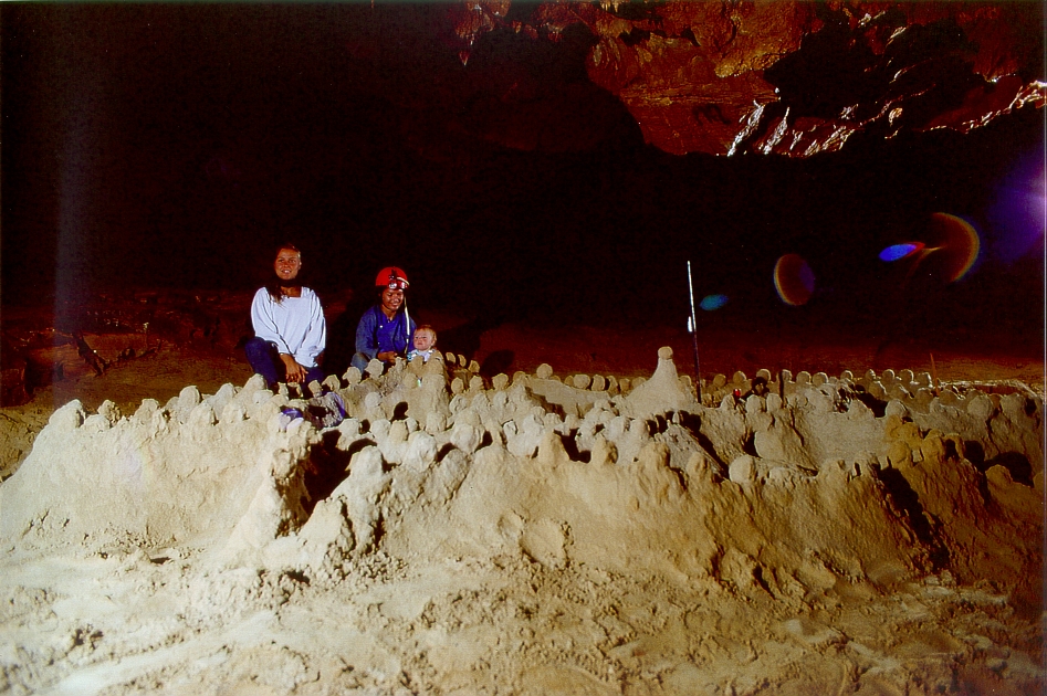
In der Sandhalle war eine schöne Sandburg aufgebaut, etwa 5x5m im Umfang. Der kleinen Hannah hat das Ganze Spaß gemacht. Selten wird sie stundenlang getragen.
In the Sand Hall, a beautiful sandcastle had been built, about 5x5m in size. Little Hannah really enjoyed the whole thing. It’s rare that she gets carried around for hours.
In der Höhle gibt es eine Stelle mit einem Bodentropfstein in der Form eines Busens.
Dieses Motiv forderte natürlich heraus. Wenn dann noch das passende Modell zur Verfügung steht, gelingt die Fotoserie. Vor der Höhle gibt es im Sommer genügend Auswahl…
Inside the cave, there is a spot with a stalactite shaped like a breast.
This motif was, of course, a challenge. When the right model is available, the photo series comes together. In front of the cave, there’s plenty of choice in the summer…

Der aktive Austritt des Wassers aus der Agios Demetrios ist die
Drakos-Quelle
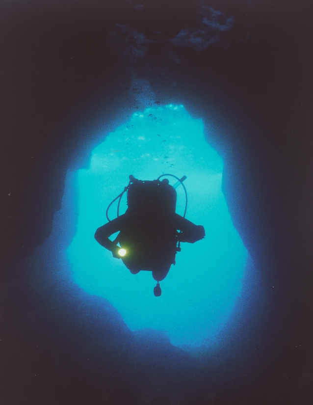
Sie liegt nur ein kurzes Küstenstück weiter südlich und hat zwei wunderschöne Siphons ins Meer.
The active water outlet from Agios Demetrios is the
Drakos Spring
It is located just a short stretch of coastline further south and has two beautiful siphons leading into the sea.
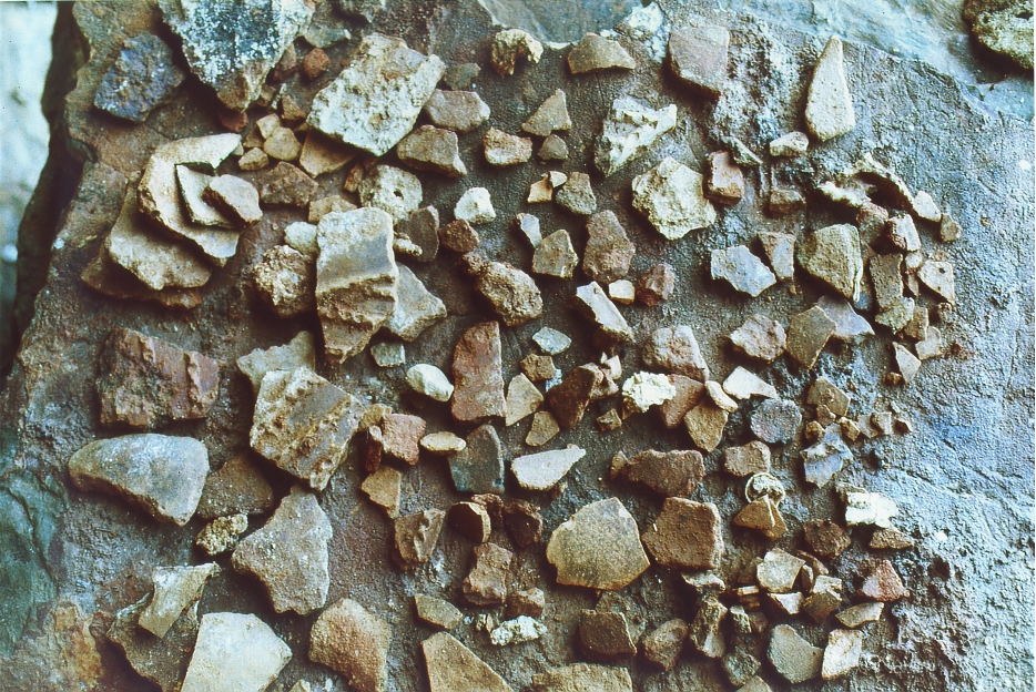
Alle Höhlen der Mani waren in den 70er und 80er-Jahren noch voller neolithischer Befunde.
Das Problem in Griechenland war aber, dass die gesamte griechische wissenschaftliche Gesellschaft die Befundlage verschlafen hat.
Die griechischen Speläologen kooperierten aus kommerziellen Gründen mit dem Fremdenverkehrsamt und hatten sich allein die Kommerzialisierung von Höhlen zu ihrer Aufgabe gemacht. Damit wurde jede neu entdeckte Höhle breit publiziert und in jede Touristenkarte eingetragen. Gleichzeitig gab es absolut keine Schutzmaßnahmen.
Im Gegenteil: Die orthodoxe Kirche im Verbund mit dem allmächtigen archäologischen Ministerium waren an allem vor Christus und vor der klassischen Archäologie (Akropolis et al) nicht interessiert. Ur- und Frühgeschichte war absolut out.
So verschwanden schon in den 70er und 80er Jahren fast alle Befunde.
Schuld war die Politik, die Kirche, die Wissenschaft, die Ministerien – alle verantwortlichen Personen jener Zeit.
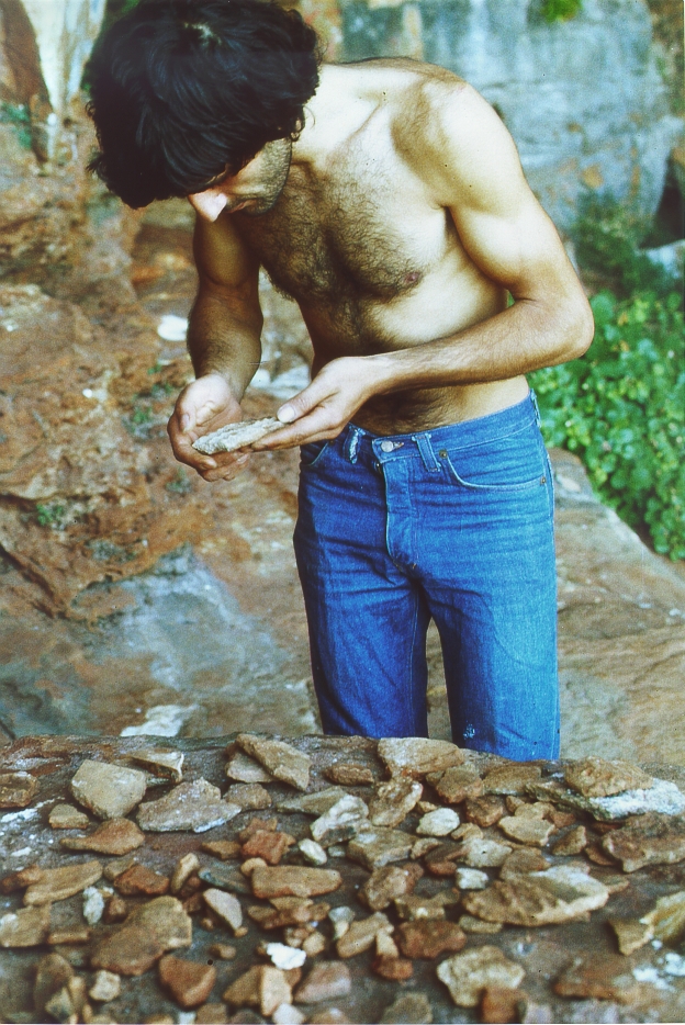
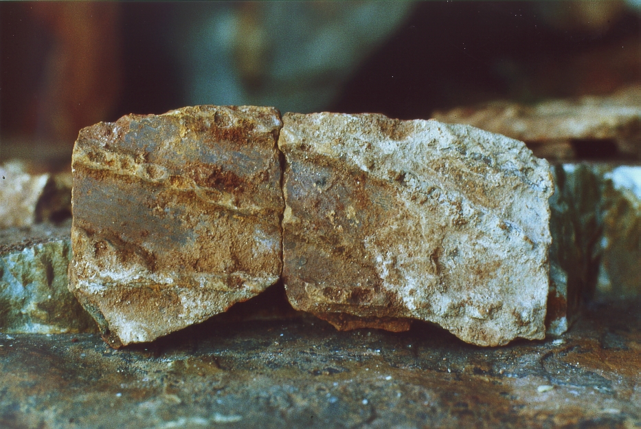
Während immer wieder vorgebracht wird, es seien die Touristen in Verbindung mit Sammlern, die die natürlichen Schätze des Landes entführen würden, konnte ich vor allem einheimische Griechen beobachten, die Tropfsteine abschlugen und abtransportierten oder die Jahr für Jahr Scherben aufsammelten und die Höhlen systematisch leer räumten.
Einen Beleg dafür konnte ich fotografieren:
All the caves in the Mani were still full of Neolithic finds in the 1970s and 1980s.
The problem in Greece, however, was that the entire Greek scientific community had overlooked the findings.
For commercial reasons, Greek speleologists collaborated with the tourism board and made the commercialization of caves their sole mission. As a result, every newly discovered cave was widely publicized and marked on every tourist map. At the same time, there were absolutely no protective measures in place.
On the contrary: the Orthodox Church, in collusion with the all-powerful Ministry of Archaeology, had no interest whatsoever in anything predating Christ or classical archaeology (the Acropolis, etc.). Prehistory and early history were completely out of fashion.
Thus, almost all findings had already disappeared by the 1970s and 1980s.
The blame lay with politics, the Church, academia, the ministries—all those in positions of responsibility at the time.
While it is repeatedly claimed that it is tourists in collusion with collectors who are stealing the country’s natural treasures, I observed primarily local Greeks chipping off and removing stalactites or, year after year, collecting shards and systematically clearing out the caves.
I was able to photograph evidence of this:
Pläne
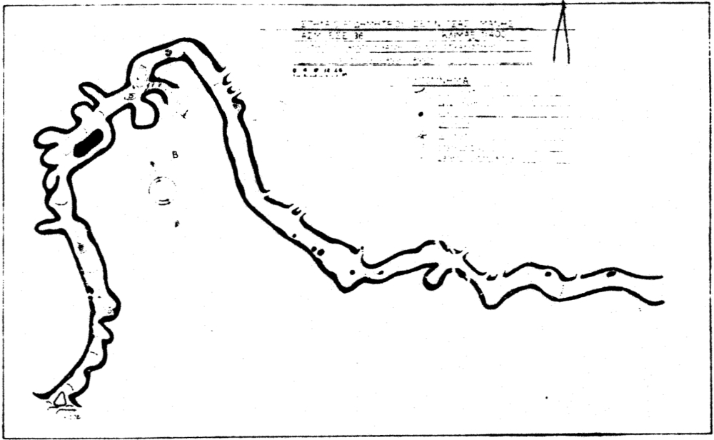
1976 veröffentlichen die griechischen Speläologen im DELTION den ersten Plan mit dem vorderen Teil der Haupthöhle
In 1976, Greek speleologists published the first map of the front section of the main cave in DELTION
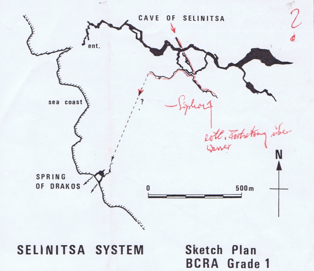
Die britischen Höhlentaucher um John Cordingley liefern über ihre Vermessungen nach der Expedition von 1982 zum ersten Mal einen Übersichtsplan
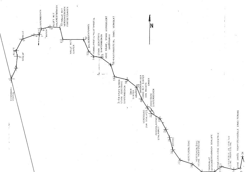
Unsere Vermessungen ergeben zur Haupthöhle vom Eingang bis zum Siphon folgende Vermessungsstrecken:
The British cave divers led by John Cordingley provided the first overview map based on their surveys following the 1982 expedition
Our surveys yield the following measured distances for the main cave from the entrance to the siphon:
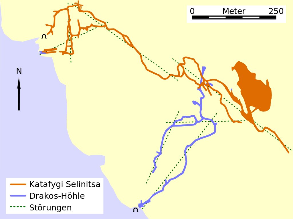
Plandarstellung aus wikipedia “Drakos-Selinitsa-System”
Wenn man die Pläne vergleicht, fallen die enormen Unterschiede in der Verlaufsdarstellung zwischen der Planaufnahme der griechischen Speläologen unter Petrochilou und allen anderen Planaufnahmen auf.
Die Fehlerquellen wurden über den Rundzug korrigiert, die durch die Betauchung des Siphons zur Drakos-Quelle möglich wurden.
Dort, wo ich nach dem Abzug der Engländer den Weiterweg in den Berg fand und verfolgte, endete meine Leine auf einer weiten Sandeinschwemmung. Die Decke lag nur 1 bis 2m unter der Wasserlinie.
Die Engländer tauchten in den 80er Jahren dort weiter.
Ich konnte seither nicht in Erfahrung bringen, ob nach dem Siphon upstream eine lufterfüllte Höhle gefunden werden konnte.
When comparing the maps, the enormous differences in the depiction of the course between the map survey by the Greek speleologists under Petrochilou and all other map surveys are striking.
The sources of error were corrected during the survey, which was made possible by diving through the siphon to the Drakos spring.
Where I found and followed the path further into the mountain after the English team left, my line ended at a wide sand deposit. The ceiling was only 1 to 2 meters below the waterline.
The English continued diving there in the 1980s.
Since then, I have been unable to determine whether an air-filled cave was found upstream of the siphon.
Siehe
Griechische Höhlentaucher haben inzwischen einen Film eingestellt:
https://www.grafasdiving.gr/caves/drakos-selinitsa-cave-system-mesinia/#lg=1&slide=14